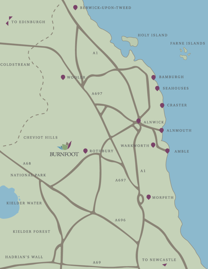
Nestled between the Cheviot Hills and the River Coquet, Burnfoot is a quarter mile from the village of Netherton and six miles north-west of Rothbury. Alnmouth, Alnwick, Amble, Bamburgh, Cragside, Craster, Farne Islands, Hadrian’s Wall, Holy Island (Lindisfarne), Morpeth, Seahouses, Warkworth, Wooler and the Scottish Borders are all within a short drive.
The cottages are located on the edge of the Northumberland National Park within a nationally important Area of High Landscape Value. They are set on the banks of Wreigh Burn in a Site of Special Scientific Interest.
Directions
For sat-nav directions, the postcode is NE65 7EY.
To navigate to Burnfoot Holiday Cottages from the A1, take the A697 Coldstream road, then the B6344 signposted to Rothbury. The B6344 ends at a T junction. Turn left here on to the B6341 and proceed straight through Rothbury and on to Thropton.
Just as you enter Thropton, immediately after the Cross Keys public house on your right, turn right towards Snitter and Netherton, then first left, again towards Snitter and Netherton, following the road through Snitter and on towards Netherton.
Five minutes after Snitter, the road drops down towards a small river. Immediately after the river, you will find our entrance on the right after the first converted farm building, opposite Burnfoot House on the left.
Please note that Burnfoot House is not owned by us, so please respect the owner’s privacy.